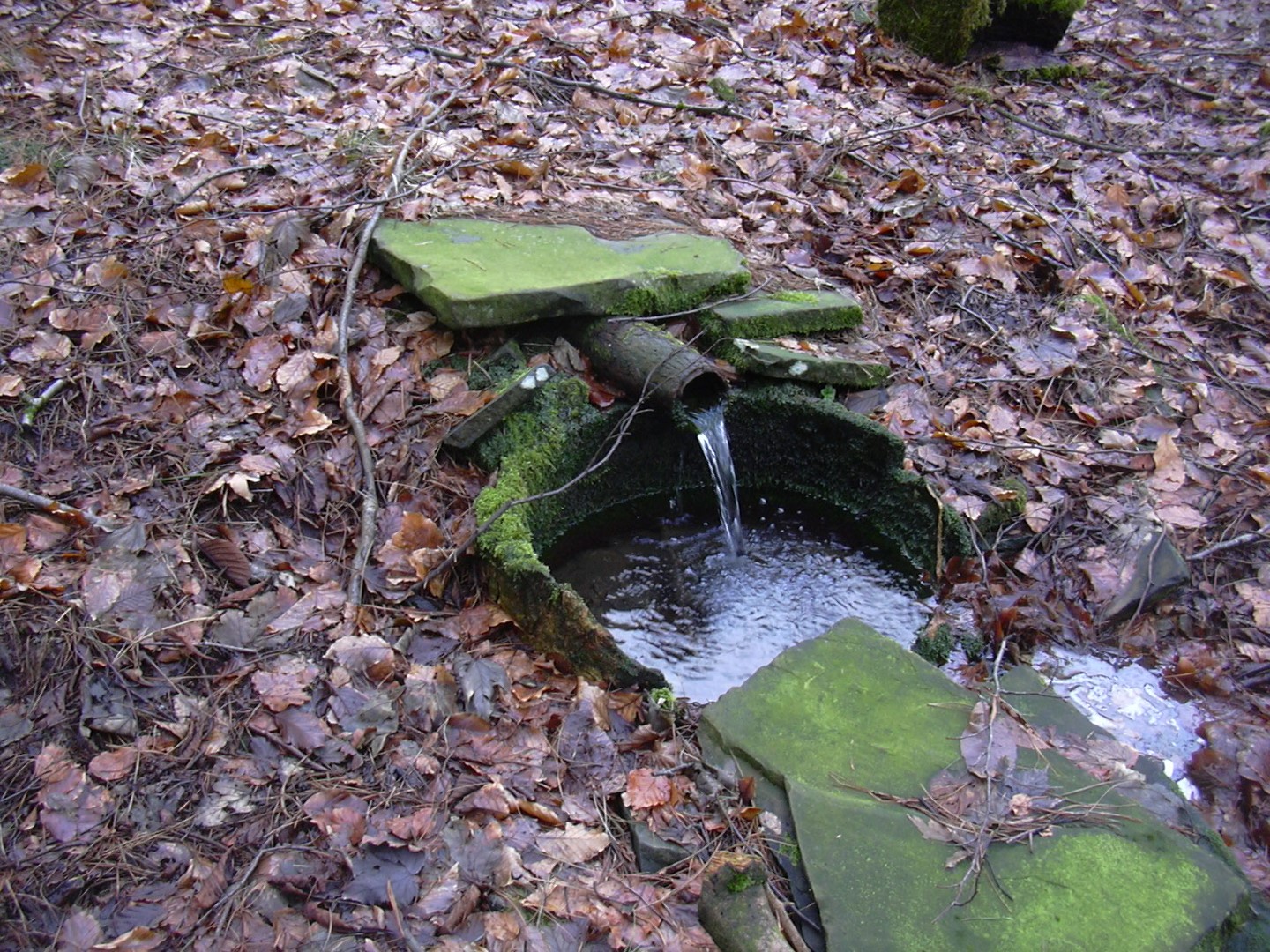
There will probably be hundreds of springs throughout our area together with lots of troughs and wells lining the various water courses. Obviously we cannot record them all, but here below I have compiled a list (which is ongoing), and in some cases with photographs of the many fine examples I have collected along with the many contributors who are giving their valued help with this project (listed below).
For obvious reasons "water" is the most important thing we have (after fresh air of course!), so to record these historic water courses and their access points can only be a very beneficial project, and will hopefully add to our overall picture of just where they all are! To think back at one time most of these wells would have been the only source of drinking water for the people of both Haslingden and Helmshore. Sadly it appears that some of these wells have become redundant nowadays, and some have sadly had their water courses diverted (diverted where? and by whom?), but thankfully most of them still remain intact.
It is also interesting to find names of buildings or local areas which have taken on their names directly relating to "WATER, SPRINGS, WELLS and BROOKS" and here are a few examples:
BROOK STREET, (Hud Hey to Worsley Park with Swinnel Brook running under the actual road itself), COLDWELLS (Off Higher Hud Hey Road), SPOUT HOUSE (Off Haslingden Old Road), SPRINGFIELD LODGE (Behind and to the left of the Rose and Crown) SPRING LANE (between Lower Lane and Blackburn Road, (old original - SPRINGSIDE (properties now gone - off Spring Lane and above Blackburn Road), SPRING STREET (properties now gone and ran parallel and to the South side of Queen St - now the West View estate behind the Griffin Pub.), SPRING VALE, (area at the bottom of Charles Lane), SPRINGWOOD, (Manchester Road below Bentgate on way to Ewood Bridge), WATERFALLS (area approached from Moor Lane - opposite Farmers Glory), WATERFOOT (Mayfield/Flaxmoss area Top of Jubilee Road Haslingden), WATERFOOT HOUSE (was off Grane Road near to the late Coronation Street/Every Street), WATERSIDE ROAD (Off Grane Road/Charles Lane), WELL BANK (Off Victoria Street), WELL HOUSE (corner of Victoria Street and Blackburn Road), WELLSPRING FARM over Grane, WELLS STREET (off Bury Road).
Also we have several well established "Brooks and Streams" which usually make their way down to the reservoirs or to either Swinnel Brook, River Ogden or the River Irwell. Here are some of these:-
Our main secondary water courses (adding to this list on a regular basis)
WOODNOOK WATER Comes down Northfield Road, Rising Bridge crossing over the road towards the old railway track and onward towards Woodnook, Accrington.
DUCKWORTH CLOUGH BROOK from Cribden bottom next to the Laund Hey Playing Fields and makes its way eventually to Clough End
COLDWELLS/MARTIN CROFT From Haslingden Moor past Coldwells into the Martin Croft Clough bottom which runs to the south west side of Martin Croft Farm (see old postcard below) and shortly after the farm (50 yards approx) turns to a right angle and crosses the field to join the Swinnel Brook.

This photo shows a approx sketch of the two watercourses coming off the Haslingden Moor (Click over to enlarge)
Sorry it should read SWINNEL and not Irwell as printed above, ammendment will be made shortly.

Shows the brook/stream that comes through from off Haslingden Moor, down via Coldwells, Martin Croft Clough and eventually joins the Swinnel
WATERFALLS From near to the Old Smallpox Hospital (Copy Farm) which borders Haslingden Moor (Moor Lane access opposite Farmers Glory), then makes its way down through a Clough, locally known as the "Waterfalls", and on past the West side of Sunny Field farm and continuing South through to Carrs then runs alongside Todd Hall Road for a short while before then crosses over to eventually join up with the Swinnel.
JINKY OR GINGKY BROOK from Cribden and breaks just below Spout House crossing the road and makes its way to Back Laneside Road (Sizehouse), Sykeside
HEAP CLOUGH
DEEP CLOUGH
PRIESTENTAX the water runs off the Moor via Priestentax and almost follows the lane for part and then veers off to the field and eventually comes over the Troy Quarry which you can see in the following photograph.

You can see stream coming from the field and comes over the top Troy Quarry (Click over photo to enlarge)

Grane Head Brook to the West Side of Bentley House (Click over enlarge)
GRANE HEAD BROOK Starts over on Egerton Moss and collecting waters from there and the Top O'th Moss and Bentley Moss and runs down the West side of Bentley House and into Grane Head just before the water enters the Calf Hey Reservoir.

This is the route of Hog Lowe Clough and part of whats commonly called "Fairy Glen" (Click over to enlarge)
HOG LOWE CLOUGH (also known as "Fairy Glen" and Clough Side at the bottom) Starts over on Bentley Moss and the waters continue down the Clough known as Hog Lowe Clough and down to Clough Side just before the water enters the Calf Hey Reservoir.
************************
Top O'th Slate
I clearly remember another spring catchment in the field immediately bordering the East of Top O'th Slate Nature Site. A area on the site where there is a picnic table if you just go a few yards behind the table and up the incline and immediately over the wall its there. This could be and I do stipulate could be (because I do not have any evidence, but may relate to a branch off from the ones we have recorded in High Street and Spring Lane) It would be great if this could be investigated!
High Street - Hudrake
The area which is now built on with modern houses, prior to this it had been pens and allotments, prior to this it was land owned by Baxters Brewery. You can (or could) gain footpath access from High Street through a snicket in the wall. You can also gain access from below on Lower Lane. (The same Spring that fed the brewery also was responsible for the feed to the Spring Lane well).
On 29th January 2016 David Cardwell wrote:
"Talking about wells at the top of Hud Rake were it changes to High Street there used to be pens and inside there is a well covered that would feed the watering hole down Spring Lane. Me and my dad uncovered it one day, it was so deep, and when you dropped a stone into it you couldn't hear it hit the bottom"
Spring Lane (Was also known previously as Pagg House Lane) Runs between and connects Lower Lane and Blackburn Road. At one time the old Haslingden Workingmen's Club was built at the side of the well.
 |
Spring Lane Well (Click over photo to enlarge) |
It is said that the origins of this watercourse start somewhere up on Cribden and are picked up around the old Top O'th Slate/Higher Lane areas. It is also said that this particular watercourse was the "water input" for the late Baxter's Brewery which was based at the top of Spring Lane adjoining Lower Lane. The water fed the brewery whilst at the same time continuing its path to this very old communal drinking water well. The local communities of both Spring Lane and also Springside would have used the well. (Springside was almost opposite the well and the Workingmens club and ran alongside what is now named Pagg House, it was a row of small cottages which were demolished many years ago, it ran parallel and elevated above the Blackburn Road and ended more or less just before the small entry to the Parish Church Grounds). For Springside see photo below.
16th January 2016 - John McGuire (Ex Pat - Australia)
Hi Bryan,
Our family
lived on Blackburn Rd. Near Jimmy Howley’s chemists. I remember, in Winter,
when the water pipes froze up, going up Spring Lane with Mum and Dad to
collect
water for drinking and cooking. Probably washing too. This would have been late
1940’s.
Regards,
John
McGuire
16th January 2016 - Joyce Thorne
I remember around 1960 people came to the well for water due to rationing they formed a queue right to the top of the Lane. I recall my mum clearing the well of all the stones people had thrown in. Around 2000 I went for some water. However possibly due to a changed water course no water runs at the well now (since 2015).
Springside (off Spring Lane (Pagghouse Lane)- elevated and overlooking Blackburn Road)

Springside properties can just be seen in this photo prior to demolition - they are the houses which are elevated and running at the back of Blackburn Road (Click over to enlarge)
Photo: kindly contributed by Heather Holden
 A
A photo of "below Springside" on Blackburn Road which you can see water cascading over the bank with large Icycles in the winter (Click over photo to enlarge)
There is also a natural spring which runs under Springside and shows itself coming over the banking (in this photo), and is probably more noticeable during the severe winter when you can see large icicles cascading.
Clough End (almost opposite Stone House and Clough End Farm)

Trough at Clough End on way up to Sherfin/Duckworth Clough (Click over photo to enlarge)
Photo: Kristy Burbidge 2016)
Obviously the watercourse must have origins from Cribden and lower and draining through this bonk which lies below what was Duckworth Clough Mill (prior: Duerdon Clough Mill). Once a cotton mill and later a sawmills and now a private modern housing development.
Years ago I worked for Shepherd Bros who took over the old Mill and changed its use to Sawmills and Timber Importers. I do remember on a couple of occasions that something went wrong with the water supply to the offices and also the mill and to correct it I had to go to a small spring/reservoir which was covered in by a timber frame with sloping roof which was covered with bitumous felt, and which was in a field just below the Quarry (now tip) and more or less to the fore front of the nearby property called "Greenhouses" I can't be sure but it could be that this trough could well be fed from that same "line" which would have fed the Offices and Mill.
Although when a child I do remember the trough always to contain water, in more recent times I have noticed the trough was dried out and only had leaf debris showing.

Beautiful decorated Water Trough at Clough End (Click over to enlarge)
Kindly shared to us by Krissy Rawlinson
Duckworth Clough Brook etc
From what I can remember It starts from Cribden and I first noticed it showing from the flat field at the base of Cribden which lies to the NW side neighbouring the Laund Hey Sports Field (see photo I took in 2003 - Note the white bath spring fed well)

Origins of Duckworth Clough Brook (Click over photo to enlarge)
I have in the past tried to trace things back with regards to this "Brook" which I have so far not been able to trace any name offered by any maps, so just for ease of reference I have taken the liberty (purely on temporary hold!) and for now I have called it "Duckworth Clough Brook.
Obviously a purist could trace it back to the head of Cribden, but I have found that the main noticeable source seems to start collecting from within the field shown in the above photo to the bottom right hand corner, you will be able to see a small "white bath spring" in the left hand corner of the field, (the field to its left is the old Laund Hey Playing Fields). It goes North West across this field and gathers even more at the fields boundaries and more to another entry further back and right at the bottom of the Cribden slope.

And then eventually passes under the bottom side of the forestry before coming out in good force just higher than the pathway which takes you through to Slate Farm.

I found this very interesting and its at the point higher up the banking from the photo above which shows the brook going through the forestry, almost at a point just further on than the "Anthony Barn" and you may see natural springs (or in this case a "spout of water") coming up from the ground - Here is a photograph I took back in 2003 showing the "spout of cold water". There were more examples of bubbling up from the soil (as in the next photo).

The brook then continues down the side of the bridleway (Kings Highway) for some 75 yards (see photo below)

Duckworth Clough Brook following the same route as the bridleway (Click over to enlarge)
Then when the "Brook" is almost at base level and at the point of some 30 yards approx before you hit the area where once stood Redferns farm (Duckworth Clough Farm) and the point were you would join the tarmac road that leads up to the tip. The brook turns to almost right angles at this point and culveted under the bridleway and for a short distance into the adjoining field, and can be seen in the field below coming back out at approx 20 yards into the field where it shows it with all the rushy area. (see the next photo)

Note the rushy area where the "Brook" comes out and then follows the line of the Clough (Click over the photo to enlarge)
From there the brook follows the valley line towards the old "Duckworth Clough Mill Lodge". From memory I cannot remember whether the brook goes directly into the lodge and then exits through it, or whether it runs alongside the lodge with capable sluice gates operation. I rather think it is the first option but will need to check this out next time I am in the area. From the lodge it maintains a Westerley route following the line of the Duckworth Clough itself. It goes culveted at the point where it reaches Clough End Road and then continues following the line of the road and under where the traffic lights are at Worsley Park and onward into Brook Street, after a 30 yards and at the entrance to Dog Kennel Road (or the very old cottages on Brook Street) the Brook at this point joins the "Swinnel Brook" proper.
From the point of being culveted at Clough End it will remain culveted (having joined the Swinnel under Brook St), before eventually re-appearing "open" at the point where it comes out from the bottom corner of the old Haslingden Corporation Yard and close to the old railway line or By Pass (see photo below)

Swinnels first exit after leaving Brook Street is close to the By Pass
Clough End Road (opposite the small cottages which are set back with allotments/hen pens across from them) - the ring road from Hud Rake to Worsley Park
PHOTOGRAPH ON ITS WAY
Clough End Road (turning up from the traffic lights at Worsley Park, at the junction straight in front a well was there built into the retaining wall.
PHOTOGRAPH ON ITS WAY
Near Mangholes Farm, Kings Highway, Acre

Spring well at Near Mangholes Farm, Kings Highway, Acre
(Photo I took 26th January 2004)
On the border of Acre and Haslingden and across from nearby Mangholes Farm
Near Sherfin Farm, Kings Highway, Sherfin

Near Sherfin Farm, Kings Highway, Sherfin
Photo: Annie Taylor (Acre)
Maiden Street, Acre
Maiden Street, Acre
Photo: Annie Taylor (Acre)
Situated at the top of Maiden Street on "the back road" at Acre. It is a Victorian spring fed well that still retains a original timber lining. It would have been built along with the retaining wall at the same period of the nearby houses.
Rossendale General Hospital
At the rear of the old hospital - this photo was kindly contributed by Chris Howarth.

Photo: Chris Howarth
Kings Highway
by Laund Lane (Just at the point where the footpath starts to head down towards Kirkhill Old Toll Bar) The Spring feeds into a old enamel bath at this point with the waters are collected for animal drinking.
Kirkhill Old Toll Bar (Kirkhill - Haslingden Old Road)

Kirkhill Toll House (Click over photo to enlarge)
You can see the well within the wall next to the house on this photo.
Photo: Dr. D.H. Tupling
Pittheads - Top of Wells Street


Pittheads at the top of Wells Street (Click over to enlarge)
Photo: Joan Merrill
Joan Merrill added: My uncle, Jim Mead, the man with the bucket in the first photo, lived in one of the cottages at Pitt Heads, before moving to Wells Street. He kept the garden at the top of Wells Street and in the late 1950's there was a burst water main in the area and as you can see a queue formed by the well. He and his friends were kept busy all day.
Back Hindle Street - Water Tanks (originally Central Haslingden)

Very interesting piece from Michael Mullaney (1st March 2016):
Whilst the attached is not a water trough or well, its worthy of consideration, just where did the townsfolk get their water from.
The picture is of houses in Back Hindle Street which were built in the mid 18th century. Haslingden did not have piped water or sewers etc until a hundred years later and then only for some.
Halfway up the properties can be seen two sets of stone supporting arms, built into the construction. On these arms would sit water tanks constructed from large stone slabs bolted together and lined with lead. Rainwater from the roofs would be collected into the tanks and then used as a water supply for the homes. This water considered a safer means of supplying water as many sources ran the risk of being contaminated by poor drainage etc.
The house at the corner of Well Bank (Well House) and Blackburn Road still has its tank supports on the back wall.
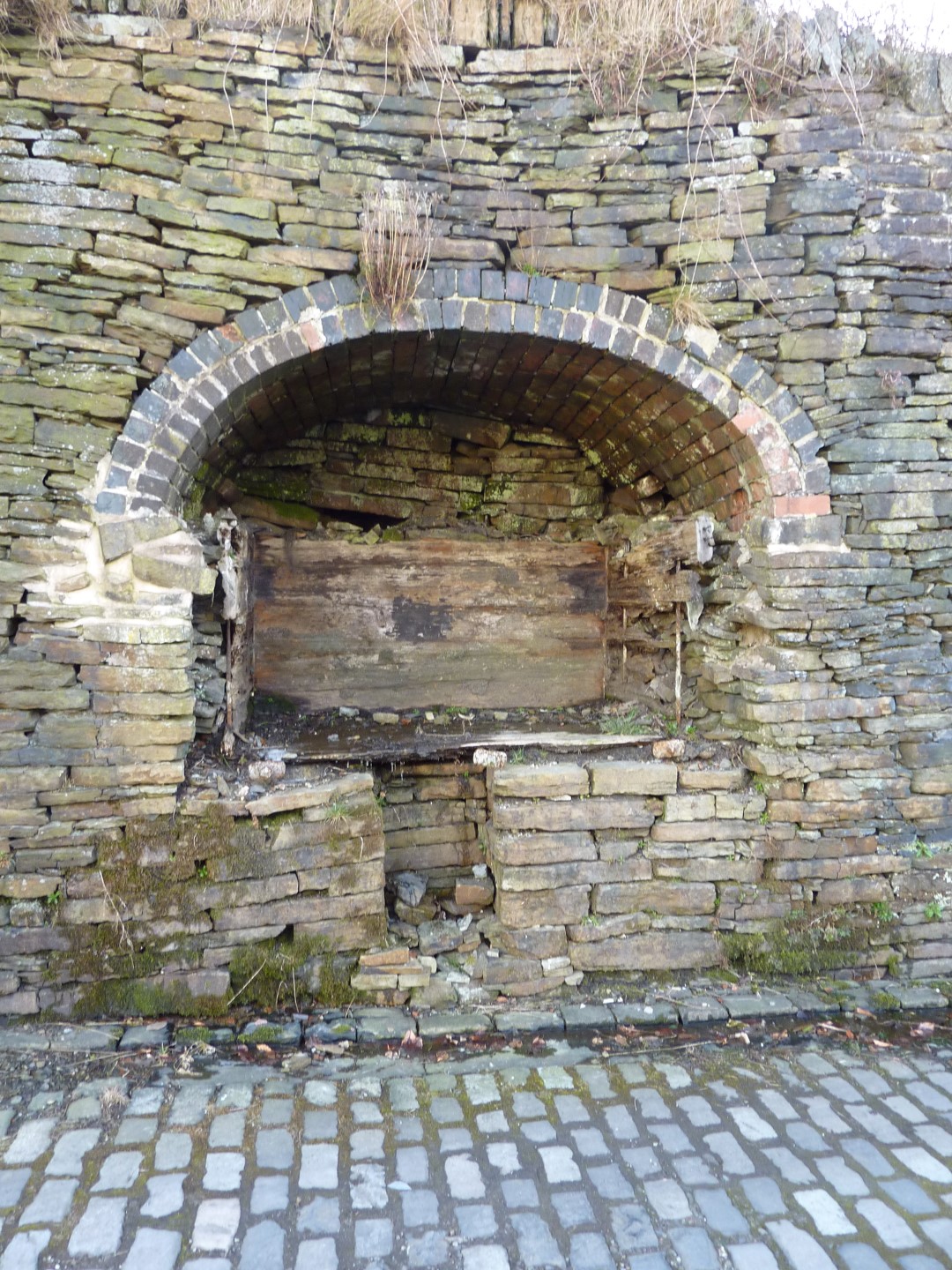
Spout House (Laund Lane, Off Haslingden Old Road )

Spout House, Laund Lane, Off Haslingden Old Road (Click over photo to enlarge)
"I now passed up by "Spout House," so called from the flush of waters bursting forth from the hill at its rear waters which course away in most circuitous channel, and, in their sweep towards the river, accomplish herculean work. Should the rambler follow them he will find they pass through the lower fields to Lonsdale's Buildings, where they are utilsed by Messrs. Ormerod's for sizing. Thence they flow onward to the foundries, and to the reservoirs of Syke Side. Next, the woollen works of Messrs. Smith are served by their volume, to be afterwards delivered at the Fall River Weaving shed. From this point they flow towards the Holme, emptying themselves through the grounds of Joshua Townsend, Esq., into the Irwell below. Few people, as they pass these grounds, and note the channel flowing through them, and the fountains play, associate them with the spout of water bursting forth from Cribden side, or dream of the mighty work which it accomplishes in its short and circuitous course. (information taken from the publication "Rambles around Rossendale".
Jinky or (Ginky) Brook
(Just below Spout House above Haslingden Old Road and continues down and across to the South towards Sizehouse (Back Lane)
HOPEFULLY TO HAVE A PHOTO SOON
Back Laneside - Opposite Size House Mill
(Nowadays Size House Village apartments)

Well at Back Laneside - Sizehouse (Click over photo to enlarge)
Photo: Robert Wade (Wadey) and uploaded here on 18th Jan 2016
15th January 2016 Michael Mullaney wrote: There is a deep stone trough in the wall opposite what was the Size House Mill on Back Lane. Not sure just where the water came from but there was a mill lodge just back a short way and to the side there was a small stream which we called "Jinky Brook", which broke ground just below Spout House. Its Sunday name if any I believe was Jenkinsons Brook as it supplied water to a mill known as Jenkinsons. This is now all culverted and runs under Size House Village, but used to continue down to Syke Side.
Originally, Back Lane was the main old and ancient highway from Haslingden to Edenfield, Bury and beyond with just a few cottages and farm adjacent to Size House Mill.
Junction of Kirkhill Road with Oakenhead Wood Road

Well behind door at Junction of Kirk Hill Rd with Oakenhead Wood Road.

It is at the
junction of Kirk Hill Rd and Oakenhead Wood Rd and is down a flight of
steps behind the door opposite the sign to the wood. I have known it be used,
years ago, by the occupiers of the cottages on the left at the top of the lane
before the bend. It is behind the grit box. The farm to the right is Fred Pilling's, where,
according to the 1909 map, there is another well in the farm yard. I used to
haymake for his dad as a kid .
John R Edwards
PS On the barn across the road was a bench mark - 951 ft.
St. Peters Avenue

This is "The Meadow" which runs at the Helmshore Road corner with St. Peters Avenue. The photo was taken before it was landscaped and you can just see part of the "well" to the left hand side.
Photo: Thanks to Chris Kirby
Clifford Hargreaves wrote on 19th January 2016:
My grandfather, Ernest Ashworth, was a partner in Ashworth and Hobson, builders in Rawtenstall. His workmen were building a pair of houses No's 29/31 on St. Peter's Avenue, Haslingden. On digging for the foundations the ground was found to be somewhat suspect and on digging deeper an underground stream was discovered, and after this was diverted the farmer reported that the water supply to the well which was situated in the middle of the field at the junction of St. Peter's Avenue and Helmshore Road had been cut off.
It is reported that a belt of "quicksand" runs from under 16/18 Colldale Terrace to across the road at properties 29/31 on St. Peter's Avenue. How far this belt of "quicksand" extends I do not know, but my father used to report that when the road joining the top half to the bottom section of Jubilee Road was being laid the cobble stones used to sink into the ground.
Michael Mullaney wrote on 30th January 2016:
There was a well fed from a spring in the centre of the field on the corner of St. Peters Avenue and Helmshore Road, now its a sports field. The field was always wet and was used only for cattle grazing and hay making. When they came to turn it into a sports field it was very difficult to drain and several attempts were made before it dried sufficiently to be played on.
There is a band of sand which runs from Long Shoot across Poplar Street (under houses with dropped door and window lintels. Down Princess Street and across Sand Pits where it breaks surface, into Colldale Terrace and St. Peters Avenue and on towards Helmshore Road,. The houses in St. Peters Place are built on concrete pontoons to stop them sinking into the sandy earth.

small map showing spring
(thanks to Chris Kirby)
Opposite Station Hotel, Helmshore Road

Horse Trough opposite Station Hotel, Helmshore - Dry with flower beds
Photo: Robert Wade (Wadey)
Rear of Higher and Hud Hey Road and "Tapstone House"

White markers show 2xwells, 1 trough and also watercourses as I remember (Click over photo to enlarge)
I do remember has a child there was a trough somewhere behind Higher Hud Hey and before you joined the road to the Coldwells. I think the Spring actually ran down the rear and South side of Higher Hud Hey (public footpath as I remember) and the water ran down the side (channelled) of the footpath going under Martin Croft Road. Closeby is a property known as "Tapstone House" where there was a deep gathering well as I remember.(See next - Martin Croft Road)

Tapstone House, Hud Hey Road on the junction with Martin Croft Road (Click over to enlarge)
Martin Croft Road
In the field which belongs to Martin Croft farm and accessed from Martin Croft Road and just before the property I always knew as "Sunnyfield". The well is shown in the photo with a white circle (see the photo above "Rear of Higher Hud Hey and Tapstone".
Coldwells
(Approached from Bridge Street (1960) or alternatively from Higher Hud Hey Road)

Coldwells natural spring well
Photo: Jean Tomlinson
On January 24th 2016 Jean Tomlinson wrote:
The Photo was taken around 1960. We used to walk across Sunnyfield and up to Coldwells to collect spring water in a bottle, then we walked past a large hole which I was told was were they burned cattle which had been killed as they had foot and mouth disease.
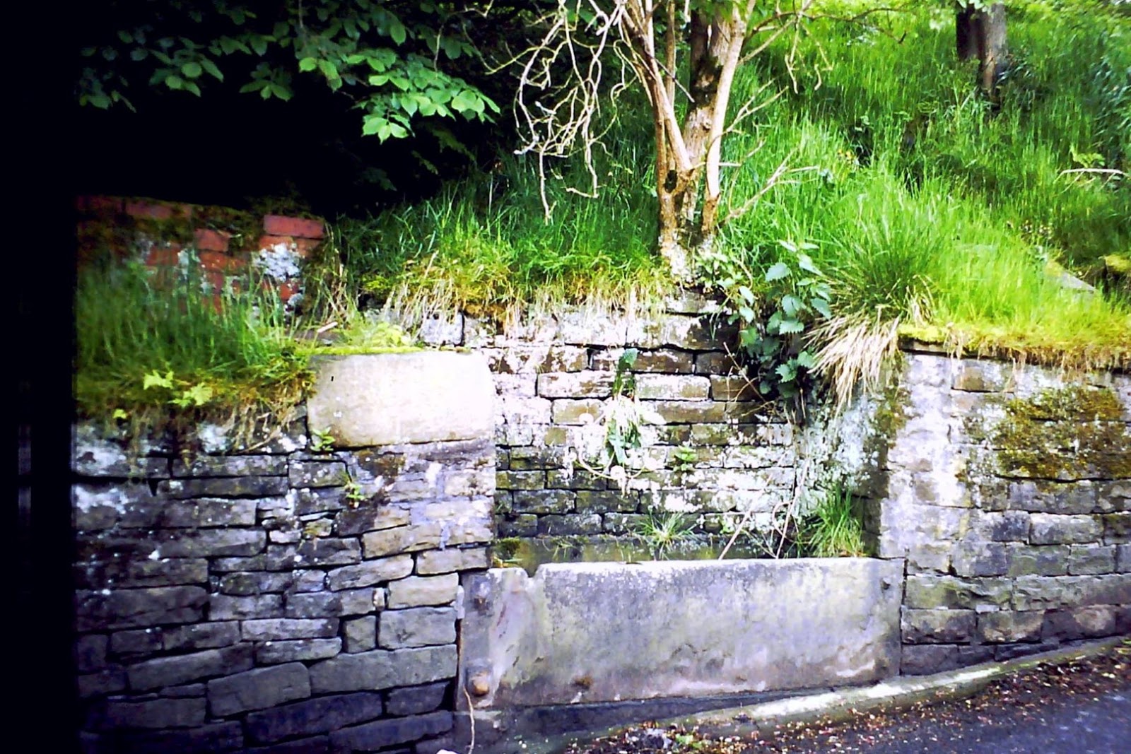
Well House (Corner of Blackburn Road and Victoria St)

Well House, Blackburn Road on the corner with Victoria Street
Once home to James Turner the dentist and later the home of Mr and Mrs. Smith
both teachers from Haslingden Modern School.
Hutch Bank areas:
Underbank
Another community well serving the old area of Underbank and Hutch Bank which lies below Hutch Bank Quarry and Cob Castle community (East facing) with the woodland area before you reach Underbank below that.
Windy Harbour Farm (Near Hutch Bank, accessed from Grane Road (Quarry Road)

Trough near to Windy Harbour Farm (Nr. Hutch Bank Quarry - (Click over photo to enlarge)
Photo: thanks to Brian Smith/Jackie Ramsbottom
Three Lane Ends (Opposite Holden Arms/Cemetary, Grane Road.
 |
Stone trough at Three Lane Ends (Click over photo to enlarge) (Photo: Brian Smith/Jackie Ramsbottom) |
Holden Vale (Holcombe Road, Near to Holden Vale Conference Centre (now closed)

Spring that floods Holcombe Road, Near to old Holden Vale Conference Centre now closed. Comes from the direction of Holden Wood Reservoir. (Click over to enlarge.
(Photo: Robert Wade - Wadey)
Holden Vale (Holcombe Rd - Old Bleach Works Offices - Bosses Car Park)

Holden Vale by the old Offices
(Photo: Peter Shuttleworth)
Some old Grane Settlements who all had/have their own wells:
Heap Clough

Trough at Jacky Barn, Heap Clough, Grane (Click over to enlarge)
Photo: Kindly contributed by Robert Wade
Stoney Rake/Lane End

Spring in the next field to the commencement of Stoney Rake (Haslingden side) (Click over to enlarge)
There are a couple of places close to here which have quite strong streams running through them from a Westerley direction and you would become aware of them if you were to take the short cut walk from Clough Head Car Park and down the footpath that goes through this small forestry to the Stoney Rake areas. It is more than likely that the spring would also at one time fed the waters to the small farmstead community which was below this area.
Calf Hey House (No 1)
Below Calf Hey
Photo: kindly contributed by Wadey (Robert Wade)
Calf Hey (2)

Just after leaving the Calf Hey Car Park (Click over to enlarge)
Photo: kindly contributed by Wadey (Robert Wade)
Calf Hey (3)

Just at the side of the lane directly at the back of Calf Hey House (click over to enlarge)
This springfed well was probably the main well from which Calf Hey House may well have used in earlier times. A fabulous little well with a cast Iron pipe feeding into a cast iron dish. I took the photo on 7th April 2016.
Hartley House
Lower Ormerods
Long House near Lr Ormerods
 A
A lovely little spring and well at "Long House" Grane (Click over photo to enlarge)
This is one of the spring fed wells that was the water source for the old Grane property named "Long House" which is approached by taking the lane between Lower Ormerods and Stoney Rake and somewhere about the middle the track goes off West to "Long House" and continues West.
Alden
 A
A Spring and trough in the Alden Valley (Click over to enlarge)
Photo: kindly contributed by Liz Dawson.
Robin Hoods Well (Alden)

Robin Hoods Well - Alden (Click over to enlarge)
Photo: Robert Wade (Wadey)
On 22nd January 2016 Dave Wise wrote:
One well in Helmshore is Robin Hood's well up Alden past the entrance to Dowry Head. When we had the water shortage in 1959 all water had to be boiled. Robin Hoods well was still giving running water as clear as a bell. My father and me used to go up there with bottles to make up the milk for my sister who was born in the June. Then the well was quite a big structure with stone sides and a roof but this was altered probably for safety reasons and the sides were removed and the stone roof now sits on the well, I am looking through old photos to see if there are any of the well. Further on from there on the path to Holcombe is the cairn in memory of Ellen Strange who was murdered there whilst walking home.
**********************************
Longshaw Brook (mainly underground)
Joins the Ogden at Bridge End, yet visible at the bottom of Greens Lane.
Springhill Methodist Church, Helmshore
There is also a water course where the Church was and this is obviously why the Church was named "Springhill"
Greens Lane (Ewood Bridge)
Trough on Greens Lane, Ewood Bridge (Click over to enlarge)
Photo: Brian Smith
Also information coming in for Hartley House, Grane, also well further over than Lower Ormerods, Calf Hey House well Laund Hey.
Thanks to: Annie Taylor (Acre) (for coming up with the suggestion of doing this particular blog) and for photos and information on Well near Sherfin, Well at Mangholes, and Victorian Well near Maiden Street (Acre), Sandra Smith for alerting me to the well at the old Helmshore Railway Station. Kristy Burbidge for the photo of the Clough End trough. Robert Wade (Wadey) for his photo of the trough opposite the Station Hotel, Helmshore and also for his photo of the well at Back Laneside, also Holden Vale spring and Robin Hoods Well and Calf Hey House No.1 photo, also Jacky Barn Heap Clough. Michael Mullaney for kindly offering the information on Back Lane, trough near to Size House Village and also for information on water tanks on Back Hindle Street. John McGuire in Australia for information regards to Spring Lane Well. Joyce Thorne for information on Spring Lane Well and also for information on Springside. Eileen Webster for alterting me to Robin Hoods Well. Marie Ives for offering the Well at the side of the old Kirkhill Tollhouse. Joan Merrill for the two photos and information about the Pittheads (top of Wells Street). Clifford Hargreaves for information on St. Peters Avenue Well. Ralph Clark for offering the spring on Kings Highway with footpath to Kirkhill. Jean Tomlinson for photo and information on Coldwells well. Andy Skipper Tullock for Waterfoot (Haslingden) Jackie Ramsbottom for information on "Spout House". Barbara Hendry for Waterside Road, Jennifer Rawlinson for Well Bank, Christine Haworth for Brook Street and photo behind Rossendale General Hospital. Brian Smith/Jackie Ramsbottom for photo of Three Lane Ends trough, Windy Harbour trough and Greens Lane Trough. David Cardwell for information on the High Street Hud Rake well. Margaret Griffiths for identifying Green Lanes Trough, Peter Shuttleworth for the photo of Holden Vale Well. John R. Edwards for photo and info on Well at junction of Kirkhill Road with Oakenhead Road. Chris Aspin for kindly informing me about Longshaw Brook and also Springhill Church, Helmshore. More on their way soon...
***********************
Haslingden's Water Fountains (3)
13th March 2016 - Michael Mullaney wrote: Local Councils in the past were charged with providing good, clean, pure drinking water hence water fountains were erected for the people to obtain drinking water from. Were have they all gone? - There is evidence of some like outside the Library and there is the Spewing Duck and the one in Victoria Park..... Michael ask were there more?

Outside of Haslingden Library (Fountain not working)

The Duckworth Memorial (Fountain not working)
Originally placed within the walls of Hargreaves Street, on or thereabouts the Ivanovic Company who had their business on that street, almost opposite where Mr. Clegg the Uniforms and Clothes shop used to be.
Can still be seen today in the small cul de sac on the right just as you start to go up Church Street. This one was also known as the Spewing Duck

Memorial and Water Spout (Fountain not working) in Victoria Park
Also here is the Swinnel Brook blog for if your interested
"Those becks that sent that gin to bloom,
That helped to power many a loom,
So precious to the marigold,
And sparkles to the stickleback
I can breathe, I can sip, I can swim, I can rejoice,
To a place what’s given this town its voice" (18th Feb 2015)

This is a map I did in the 80s showing the approximate route the Swinnel Brook takes, and also to summarize its very importance to our local community, especially so in the 19th and 20th Century, providing water to keep our many mills running and in doing providing employment for the many. (Thanks to John Simpson for kindly checking over this map in the 80s and also for making some additions at the Sunnybank/Albion Mill end)
.JPG)
The Map is far from being in scale, but does at least give a approximate indication to the route the Swinnel followed. Sadly today the majority of the Swinnel is now culveted (and in part has more recently gone through some slight deviations from it's original watercourse), and prior to the 1970's, quite a lot of the Swinnel was then "open", whereby today it is mainly covered and encased within concrete pipes or open culverts channelled in concrete with concrete side bankings.
During the 50s and 60s there where many naturally open areas of the Swinnel, as I remember the 6ft wide brook bore much beauty with areas along its route showing off it's long flowing mosses and various chickweeds wavering backwards and forwards within its fast currents, also marigolds a plenty. There where also areas of the brook where we would catch "Sticklebacks and "Bullheads" and put them in jam jars, also but rare we actually caught "catfish", even brown trout was seen now and again, and sometimes we would fish the calmer, more settled waters of the lodges, of which some bore perch and roach and most of them had good stocks of goldfish (or golden orfe). It wasnt that the lodge owners allowed fishing, you had to do it quite "sneakedly" from parts they could not see you!!
+(Large).JPG)
+(Large).JPG)
There were at least 12 mills, and could probably have been more, which depended on the Swinnel Brook for their survival, and most of these mills had lodges (water catchment and holding areas). I can remember most of these lodges, although nowadays there are few survivors, with most now having been filled in long ago, although if you look carefully, there is still plenty of evidence of where these lodges once stood. There were even more mills also further along the valley bottom towards Camms and the Helmshore district, which again operated in this area at one time purely, because of the necessity of being close to the Swinnel or the River Ogden. The Swinnel joins into the River Ogden just north of the Camms (See above photos and click on to enlarge). Going back to the beginnings, The Swinnel starts from its highest point on Cribden Moor lying
East to Sherfin Clough, and from there makes its course directly West and down the Clough into what was the Hazel Mill Lodge.
.JPG)
From leaving Hazel Mill it then did a 45 degrees and turned South going directly down to the far NE corner of Worsley Park, where it then makes another full 45 degrees and comes west again to the opposite NW corner of Worsley Park, here it again goes at 45 degrees South and heading along the park almost parallel with the road. After some 75 yard it then went under the main road and came out the other side into what was (a large open field area where W.H. Shaws coal merchants used to store their small 3/4" coal chippings which where used to keep the local factory boilerhouses going - they would access this area from Brook Street. The area these days are large corrugated warehouses or units and part of the Hud Hey Industrial area). After crossing under the road heading West for a further 100 yards, it then turned 45 degrees East for yet another 100 yards and here met up with the underground culvert, beneath Brook Street of which also other waters joined up here which had originally collected from high up and further along the Cribden Moor and also from the Duckworth Clough Areas, (Before reaching here (Brook St), and on its way down to here water was also collected within the two further lodges which were for Duckworth Clough Mill. The lodges are still there today and up until about 15 years ago they did contain some beautiful large Carp.) and these waters routed down Duckworth Clough Road and then under the main Blackburn Road (at Worsley Park entrance), and continued via Brook Street, where here they joined up with the Swinnel).
Going back to the course of the Swinnel and just yards before it met up with the culvert in Brook Street, where it was still "open", and there was a sluicegate to the right hand side which could be opened as needed to allow waters to divert into the Clough End Lodge which ran parrallel with Brook Street and Hud Hey Road (this is now filled in and a large car park area).
.JPG)
.JPG)
Where the waters meet under Brook Street, they then carry on almost following the line of Brook Street and still underground cross the main Hud Hey Road and keeping underground enter the East side of what was the Haslingden Council Yard . The old underground culvert here almost follows the boundary wall of the old Council Yard from its North East, right through to its South East corner, and at the far SE tip then re-appears once again in the open (See photo above left and click over to enlarge). After a further 100 yards you can still see the evidence of the old "sluicegate" which allowed waters at this point to be diverted to the Albert Mill Lodge as and when necessary (see photo above right and click over to enlarge).
Also at the far end of the Lodge another watercourse crossed under the cobbled road and then back again and crossed the road yet again, which lead into another lodge which was for the Victoria Mill.
.JPG)
.JPG)
Now retracing and going back to the "old sluicegate at Albert Mill" we now carry on with the main Swinnel watercourse which now drops and goes under and re-appears a few yards further along, at this point it is now "modern day open culveted and set within concrete" and this then continues to follow a almost parrallel line with what used to be the Railway. (nowadays, what was the old railway is the by-pass - Southerly traffic side). until it almost reaches what was Booth Road (or what was the Station goods yard), and here it goes underground again and rejoins its original watercourse at the East side of what was the North Hag Tunnel.. some 200 yards on..
Its worth noting that the water course has been altered from its original course here (near Albert Mill lodge entry), where it used to run straight under the railway track to the other side, and then continue flowing along the South East boundary of Martincroft Farm until it reached the Station area where it then went underground and crossed under the Station and over to the SE side, coming out and showing itself to the East of North Hag Tunnel). And the brook came into view yet again, where it came out from the culverts at the junction of Donkey Row (Bridge Street), and before long (after only maybe some 20 yards) it again dissapeared under the Commercial Mill, alongside the boilerhouse (this area was then the main route into Carrs and called (Commerce Street).
.JPG)
The brook came out at the SE corner of the Commercial Mill and also passed Paghouse Mill and then formed a further lodge (of which the brook coursed through the far side of the lodge) of Grove Mill. The lodge is now filled in but you can actually see the Swinnel at this point today (2009) and cross over its "what looks like it's original (from 50s as I remember) footbridge (see photo above).
.JPG)
.JPG)
The Swinnel carries on under Grove Mill going under what was the railway bridge, (now by pass), and came out in a lovely open area (or the East Carrs area, closeby to where there used to be a "rope works"), here it passed along in winding path in the shadows of the overlooking mature decideous trees (Click over photo on left to enlarge), and then under the main footbridge which lead all pedestrians onward from Prinny Hill to the village of Carrs which lies to the West of the Swinnel (see photo above right). It was still open at this point and bordered the West perimeter of the St. James Church Football playing fields where it went alongside the back of the large dark "creosoated timbered changing rooms", the ones we used to use when at having sports (You can just about make it out through the tree branches, on the photo above right). At this point the Swinnel probably spanned about 12ft wide. Also the cotton mill of Lamberts was just over the wall at the other side of the Swinnel (Lamberts also had a lodge to the back (or the West side) of the mill. This lodge was filled from brook waters which originated from Haslingden Moor to its West, and this brook then led on to join up with the Swinnel at around the Todd Hall Road point, SE to the corner of the Lamberts Mill.
.JPG)
The Swinnel then crossing under the Todd Hall Road, opened up again in the next field whilst it continued to meander its way South with Todd Hall and Underbank and Cob Castle lying to its West. It continued to follow the South course where it eventually came to the front (or East side) of Plantation Mill (off Flip Road) and then followed on underneath what was Hutch Bank Mill (no longer with us) There was three lodges at one time around these mills, though none of them are with us now, but I can remember one which was just off Flip Road and probably belonged to Plantation Mill. Most years it had a breeding pair of Mute Swans on this lodge and they got very protective within the breeding season, and where regularly known to try and attack you (thankfully from behind there 12ft perimeter enclosure. This lodge I am sure also got its water from the Swinnel. On leaving here It then coursed West and under the railway bridge for a short while until it soon reached Spring Vale Mill (on the opposite side of Flip Road), here it again went into another Lodge, from leaving here it went out and turned almost 45 degrees to the South along the side of Waterside Road. Across the road at this junction was Carr Parkers Mill or (Charles Lane Mill), they also had a Lodge.
Further along Waterside Road was the actual Waterside Mill. The Swinnel was open at this point and ran almost parallel at one time with Waterside Road, passing the bottom of the late Every and Coronation Streets and here would have been about 16ft wide, soon it was culveted under the railway line and eventually came out at Grane Road Mill. On the other side of the railway there was Flash Mill (Thos Warburton Ltd) whom also had a lodge, though memory fades, I rather think this lodge was fed by waters off the Hutch Bank rather than the Swinnel Brook.
.JPG)
.JPG)
Nowadays (2009) the Swinnel shortly after leaving Spring Vale Mill it is culveted yet again and heads off in a South West direction under the large mound of the present by pass, and crossing under the Grane Road, and coming out into the open again on the West side of what was the old Messrs. J.H. Birtwistle and Co. Ltd, Grane Road Mill, and then makes its way under the factorys and comes out again behind Holden Hall House and eventually joins up with the Ogden Brook, just North of the Camms.
From here on its the River Ogden, the Swinnel has done its work. The Ogden many years ago would have gone on to feed the Camms Mill, and just a little further downstream would have certainly fed the lodges of Higher Mill (Helmshore Textile Museum), and been responsible for the constant supply of waters needed to sustain the "water wheel" at Higher Mill and all mills on it Southbound watercourse.
.JPG)
"Cridden"
Cridden guards you from the East,
It was that Hill of Stags,
A beacon warns to Hameldon,
Then walk o-er bridge upon a Cloud,
To a point that tips the Crown
Before you came to Play the Deer,
Down and ordered Back – Up again,
No Stags upon them hills away,
No antlers hung by Stags heads
For riches lie within thy peat,
Hazel shouts whilst birches shine like silver,
***
Sides with Pinner-ed becks and Cavern’s drip,
Slate-d tunnels of catacombs, and shafts to echo grand,
Breached flatts with peppered pits
Where such lonely wretched moor grass sits
Vibrato cries with Curlew’s mourn,
Gruffs and Roding beats of drumming snipe,
This time when honeydew rushes ripe,
Along this god forsaken place.
***
Those becks that sent that gin to bloom,
That helped to power many a loom,
So precious to the marigold,
And sparkles to the stickleback
I can breathe, I can sip, I can swim, I can rejoice,
To a place what’s given this town its voice
***
18th Feb 2015.
(Just uploaded the above photo to another site, the photo shows Cribden in the background
and inspired me to put pen to paper) If you do prefer explanation to the poem
.jpg)
Ponds been “filled In”
A remember ambling up that road carrying jam jar by the string.
I was so pleased at what I’d caught, couldn’t wait to show my dad,
Two sticklebacks were a swimming round, many times within that jar,
All folk I saw going up Hud Hey would stop and take a look and smile.
Other times I go to “pond” to look at all that spawn,
I’d go again another day to watch the tadpoles hatch and swim.
Sometimes I’d try and catch them and let them go again,
Besides them were the “whirlygigs” who’d spin and spin and spin,
Only place I ever saw the dragonflies and little damsel flies as well,
Was down at rushy edge of that little pond down near Carr Mill,
And close by Swinnel, I’d see the Bullheads and loach we called the catfish,
They are good times to remember, how lucky we all where.
Its changed a lot since them “little boy days” and what a shame me thinks!
Most ponds and lodges are not around these days because they’ve been filled in.
In fact I can count over ten that have, and never known one new one to been made.
So it’s a reet poor do for young ones trying to learn the trade.
Bryan Yorke 7th September 2012.
Below is some work carried out by Peter Gidley (received 19th March 2014)
Swinnel Brook 2013
I read the article about Swinnel Brook in the 19th and early 20th centuries, on the Haslingden Old and New Blog. For half its length the Swinnel provided water for processing and steam in the cotton mills before meandering through open countryside. I decided to bring the tale up to date and followed the Swinnel from the confluence with Ogden Brook to the hills above Haslingden.
I started at the confluence, the site of Cams Mill, {1} a 19th century mill no longer in evidence. Although no sign of the mill can be seen the railway embankment is still present, though not in use. I walked north upstream alongside the brook. The brook proceeds for about 80 yds until it is crossed by a small bridge. In another 50 yds a weir is reached. By the side of this weir is a picturesque pond {2} which used to be the holding lodge for the Bleach works on Holcombe Road. At this point a service road and a row of bungalows for Swinnel Brook Park is found running along with the brook. The brook continues upstream for a further 300 yds until it is crossed by a footbridge leading to Mercer Crescent. The brook then passes under Grane Road Mill {3} , a 19th century building. The brook then exits from under the mill for a few yds before passing under Grane Road and the A56 to reappear on Waterside Road {4}.
The brook the follows Waterside Road, flanked on both sides by modern industrial units to Flip Road. At the junction of Flip Road and Waterside Road there is the 19th century Spring Vale Mill {5} now used as industrial units. The Swinnel follows Flip Road before passing under the A56 and reappears on the far side of Bentwood Road.
Swinnel Brook follows Bentwood Road, either side of which are modern industrial units, until it passes under Todd Hall Road. At this point a stream enters from the left. This stream comes down under Commerce Street from Swineherd Lowe. Meanwhile Swinnel Brook flows behind the industrial units on Taylor Court. Upstream of Taylor Court the Swinnel flows from under the A56.
On the far side of the A56 the brook goes past the 19th century Grove Mill {6} . Upstream of Grove Mill the Swinnel comes from under Lodge Sheet Metals, the site of the lodge which supplied Grove Mill. After Lodge sheet Metals the brook comes from under PMP Ltd. and then Reelvision.
Upstream from Reelvision after passing under Station Road, the Swinnel can be seen again at the junction of Station Road and the A56, and at a point 50yds up Station Road as the over flow from a lodge. The lodge was the water supply for two mills, Albert Mill {7} on the right and Britannia Mill {8} on the left of the lodge.
Swinnel Brook appears by the side of the A56 and proceeds alongside the A56 for about 200yds before veering away to the right. After50yds the take-off for the lodge is seen. In another 50yds the brook disappears underground in a once Council Yard {9} and the reappears in Worsely Park {10} and at a point 60yds up Clough End Road. In Worsely Park there is a small stream into which runs a more substantial culverted supply from the direction of Acre.
The water at Clough End Road comes down behind Clough Gardens {11} , a housing development on the site of the 19th century Duckworth Clough Mill. Beyond the Gardens there is a mill lodge. The lodge is supplied by two streams, one from Sherfin Side and the other from Cribden Side. The stream from Cribden Side splits into two, one from Cribden and the other from the Top of Slate.
Please see the attached map.
The red numbers appear on the map.
Photos of Swinnel Brook can be seen on Flickr at www.flickr.com/photos/pjg123/sets
.jpg) |
| Map of Swinnel (P. Gidley) |
Memories from John McGuire on "Swinnel Brook 20th Feb 2016
Hi Bryan,
I have just been re-reading the Swinnel Brook blog and remembering many a childhood fishing expedition .With a jam jar, a fishing net made from my Mam’s stocking on a wire hoop with the
ends of the wire stuck into a length of cane. I began by descending the stone steps in the middle of our terrace then down the bonk, passing between Vine Grove Mill on the right and Grove
Mill lodge on the left. I recall the Swinnel going underground around Bridge St and Pag House Lane, re surfacing between Commercial Mill and Vine Grove Mill then going underground again
to Grove Mill lodge. I then walked down the ginnel between Grove Mill and the railway line which was up an embankment to my right. At the end of the ginnel the path turned right, under the railway bridge
then followed the Swinnel . Carrs village was to the right and ahead was Carr Hall mill where I stopped to have a chat with my Uncle John Berry who worked in the devil hole at the mill.
Leaving Carr Hall mill, I crossed Todd Hall Rd. At that point the Swinnel became a meandering stream at least 4ft wide. This was my fishing spot. I usually caught some stickleback and some other similar fish.
If things were really quiet I collected frog spawn. I then went back via Prinny Hill bridge up to Blackburn Rd turned left and went home.
As this occurred in 1952-3 I will accept any amendments.
Kind regards, John McGuire